Following a visit by Norbert VK5MQ and checking his RTL-SDR dongle out I thought it might be fun to experiment with receiving the NOAA weather satellites. There are three of them circling the globe, NOAAs 15,18 and 19. They operate in the 137MHz area so can be heard on most 2M antennas.
Although I have tracking antennas, the satellites can be heard very easily. They’ve been up there for years and are quite big e.g. NOAA18 weighs 2.3 tonne was launched in 2005 and is in an orbit about 850km up. All these satellites are in polar orbit which means their path is north/south (mornings) or south/north (afternoons). Being nearly sun synchronous they appear more or less at the same time each day.
To receive the satellites you need a receiver that has a reasonably wide bandwidth, about 35kHz does the trick nicely so a software defined radio is probably best as you can adjust the bandwidth easily. I use a RTL-SDR.com Blog V3 dongle bought from South Eastern Communications in Frankston. I paid $44 which included the adaptor.
There are plenty of sites that show you how to get this going with SDR Sharp a software program that does the decoding to audio.
Use Orbitron (or one of a number of web based programs) to calculate when the satellites are going to be in view at your QTH. Orbitron is free and works well.
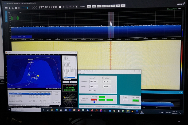
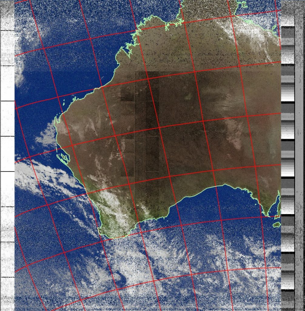
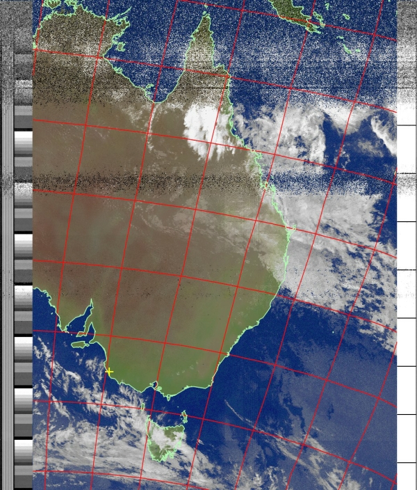
This is my main screen. In the meantime on the invisible monitor to the left, the program WXtoIMG (weather to image) is drawing the picture. This was a N/S pass so it would have drawn from the top down.
Once you have Sharp SDR working you have the audio available for decoding with WXtoIMG software. Download the Beta version of WXtoIMG from here:
https://wxtoimgrestored.xyz/downloads/
I use Windows 10.
You’ll need to enter your details in the setup of WXtoIMG. Your Lat/Long is important for the program.
Because WXtoIMG must access the sound coming out of SDRsharp program you need to install a virtual cable (not a real cable) program so it listens inside the computer. I got mine from:
https://vb-audio.com/Cable/
Download and install VBCABLE_Driver_Pack43.zip
Last job, go into your sound settings (right click on the speaker icon in the bottom right hand corner) and set your incoming and outgoing audio to the Output choose Cable input and Input device choose Cable output.
That’s it. All things being equal you should be able to receive pictures. By the way WXtoIMG does not start drawing the picture until the satellite is in view and then it starts automatically. It stops when it decides that the pass is over which is why your computer clock should be accurate.
Have a go, it’s fun and later you can use SDR Sharp and your dongle to decode weather satellites or the balloons from AREG.
John VK5DJ